Architecture Studio III 4.025 | MIT Architecture
December 2021
Instructors: Cristina Parreño Alonso
TA: Carolyn Tam
East Boston, one of the city’s most diverse neighborhoods - with the highest percentage of foreign-born citizens in all of Boston - has a complex relationship with the water. After it was annexed by Boston in 1836, the area enjoyed a period of rapid economic growth fueled by marine industrial activity; shipyards have since played a large role in the neighborhood’s identity and development.
Water has come to be perceived as a threat rather than an asset. Climate change brings the risk of flooding and rising tides. For this community in particular, the effects of flooding could be devastating. Flooding can easily cut off public transportation to the mainland; since only 14% of residents own cars, improved transit systems are an urgent need.
In order to address these problems, we must reframe our relationship with the water. Rather than fearing water or expecting the environment to bend to our will, it’s important to remember that we are part of the natural ecosystem, and instead delegate back to the hydrosphere. In other words: what are the ways that water adds value to the city?
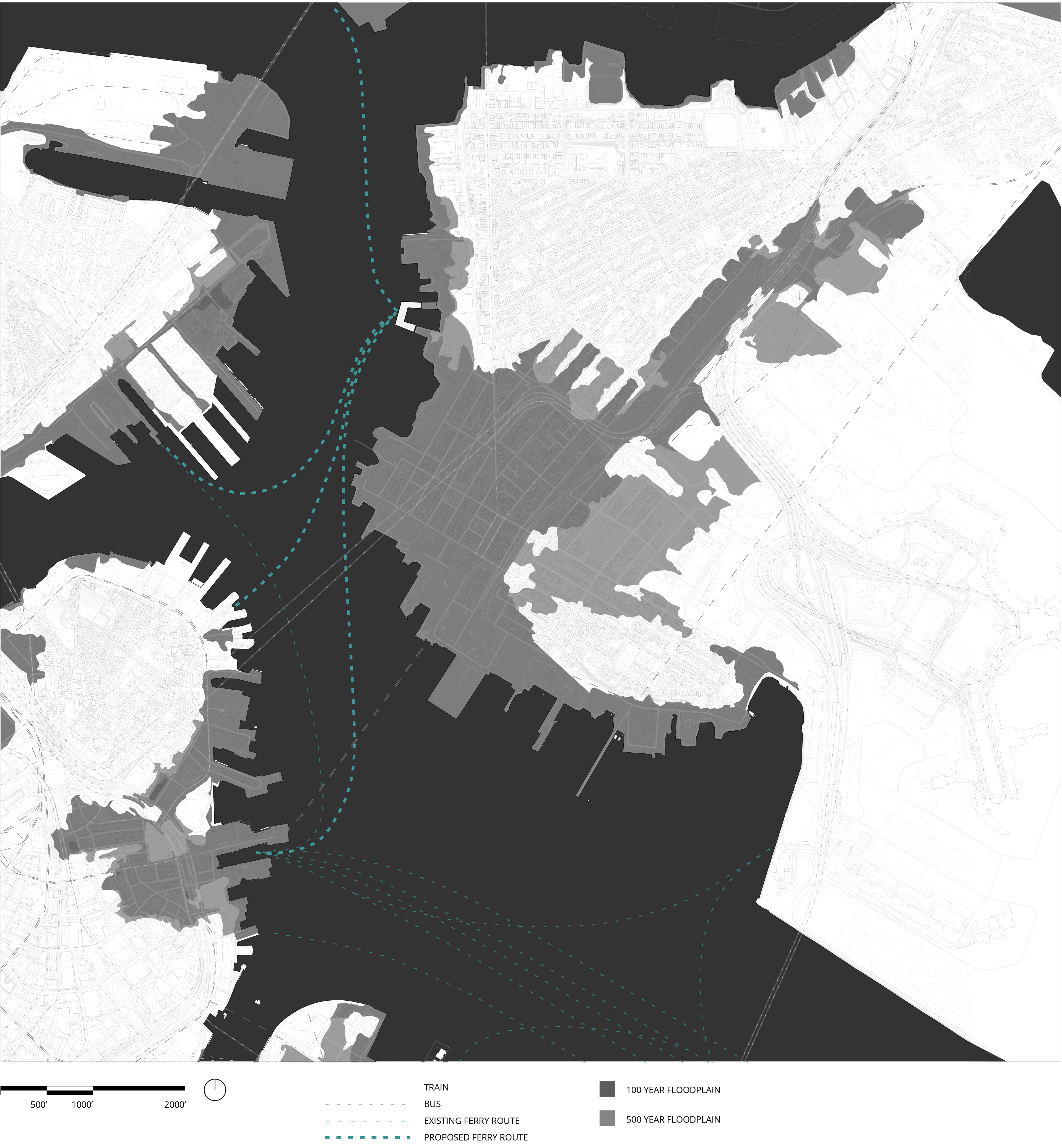
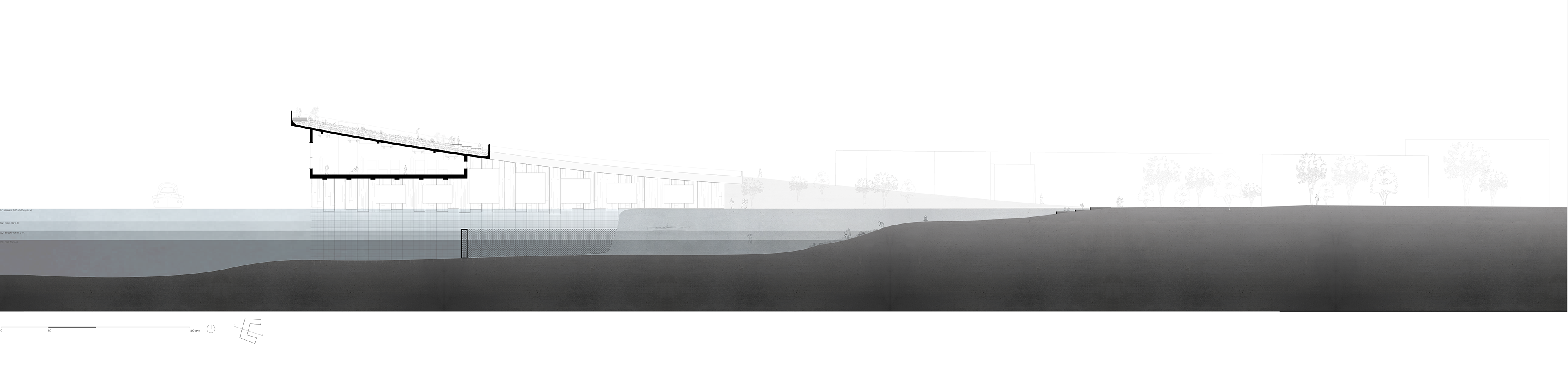
Site Map showing the site's relationship to the rest of Boston along with the transit impacts of the 100 and 500 year floodplains.
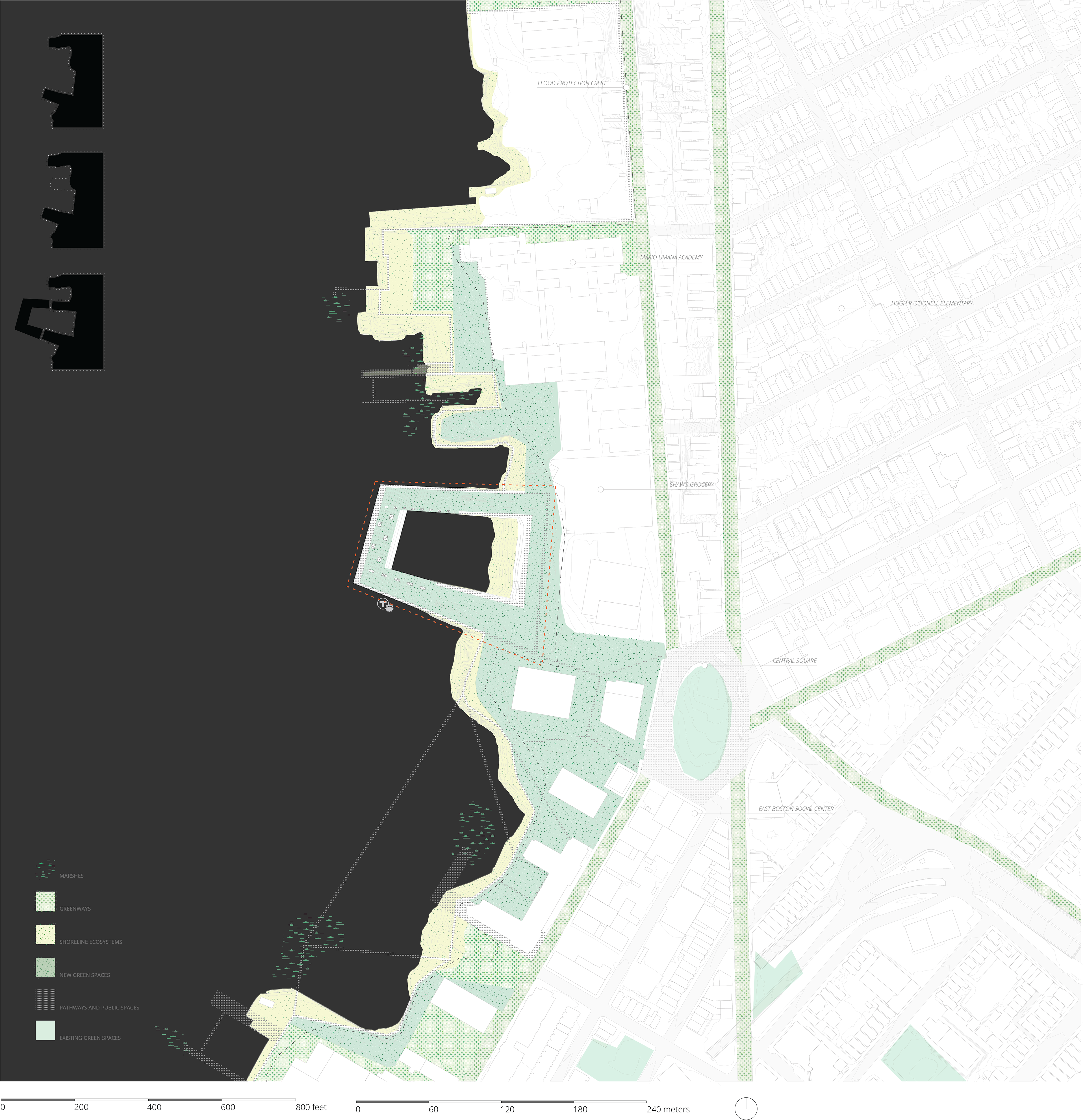
Building shown in the context of Climate Ready Boston's existing climate resilience proposals. In accordance with the idea of "softening the edge." the project is situated on a new artificial cape.

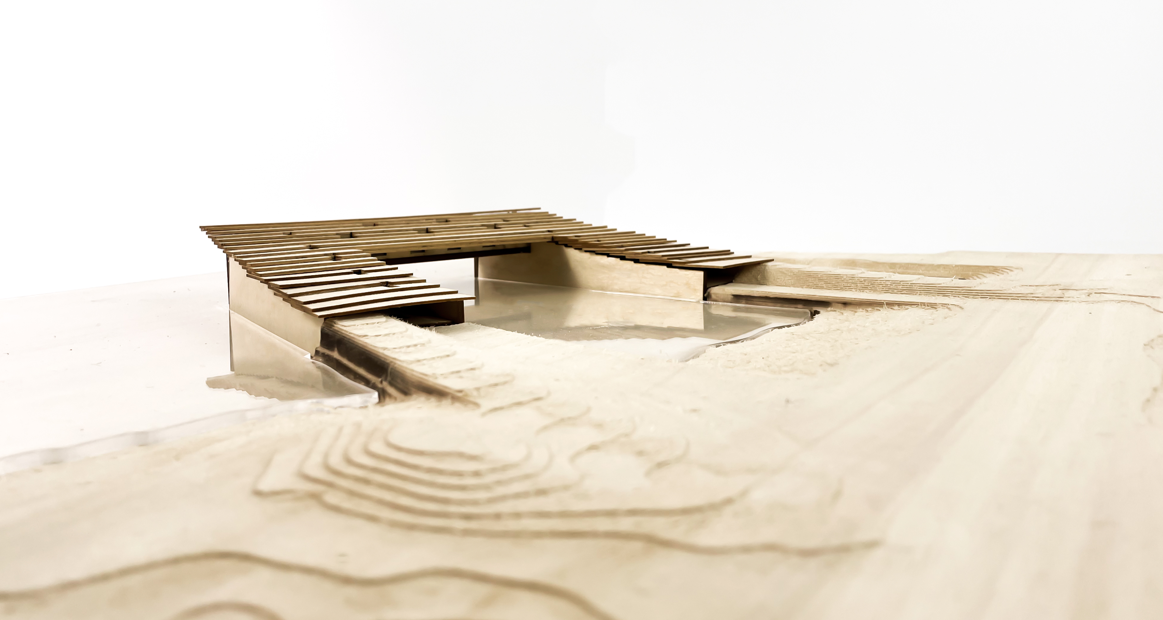
Diagram of proposed flooding mitigation techniques. The building's sloping form and green roof allow it to connect seamlessly to the surrounding landscape.
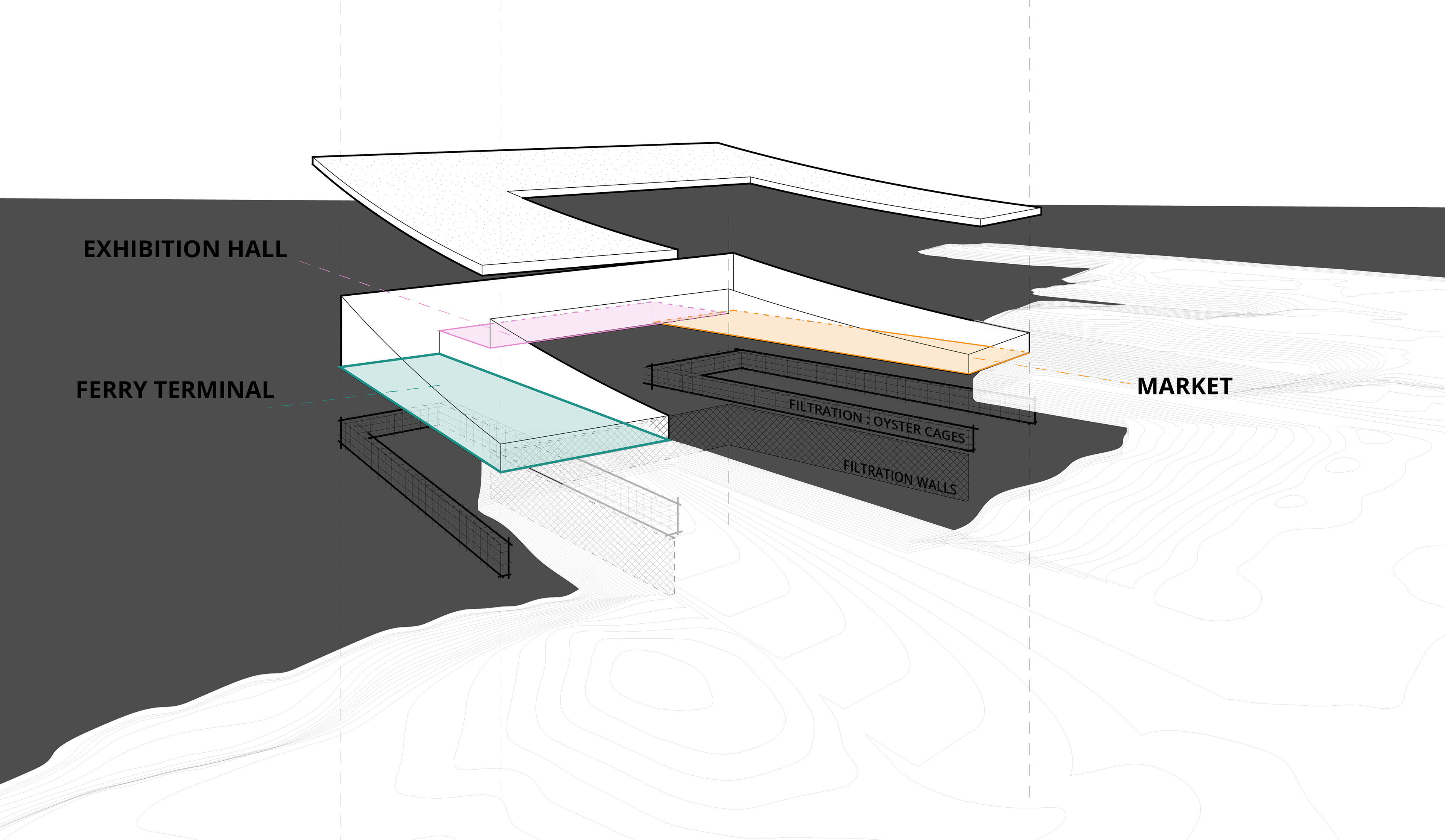
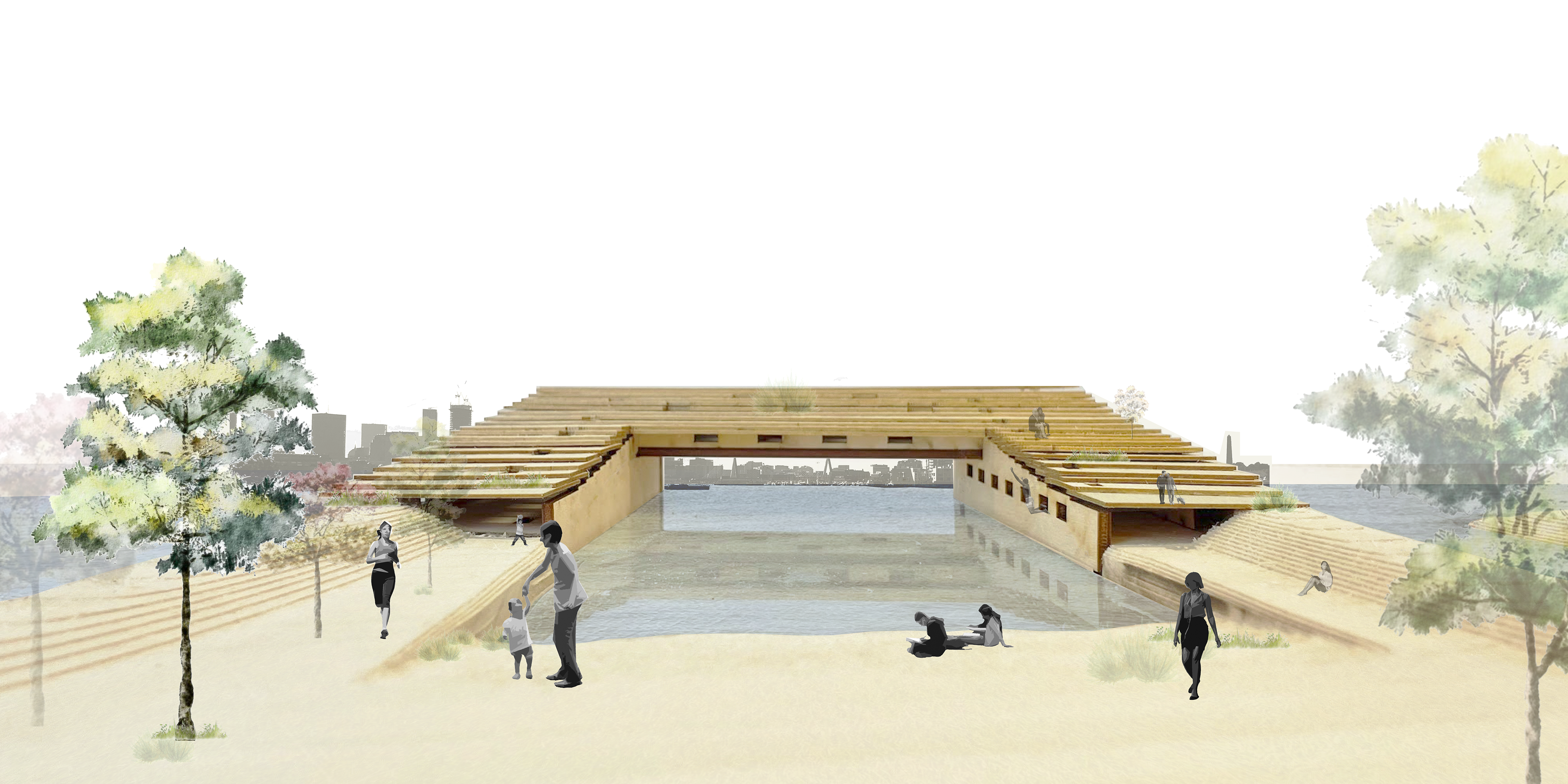
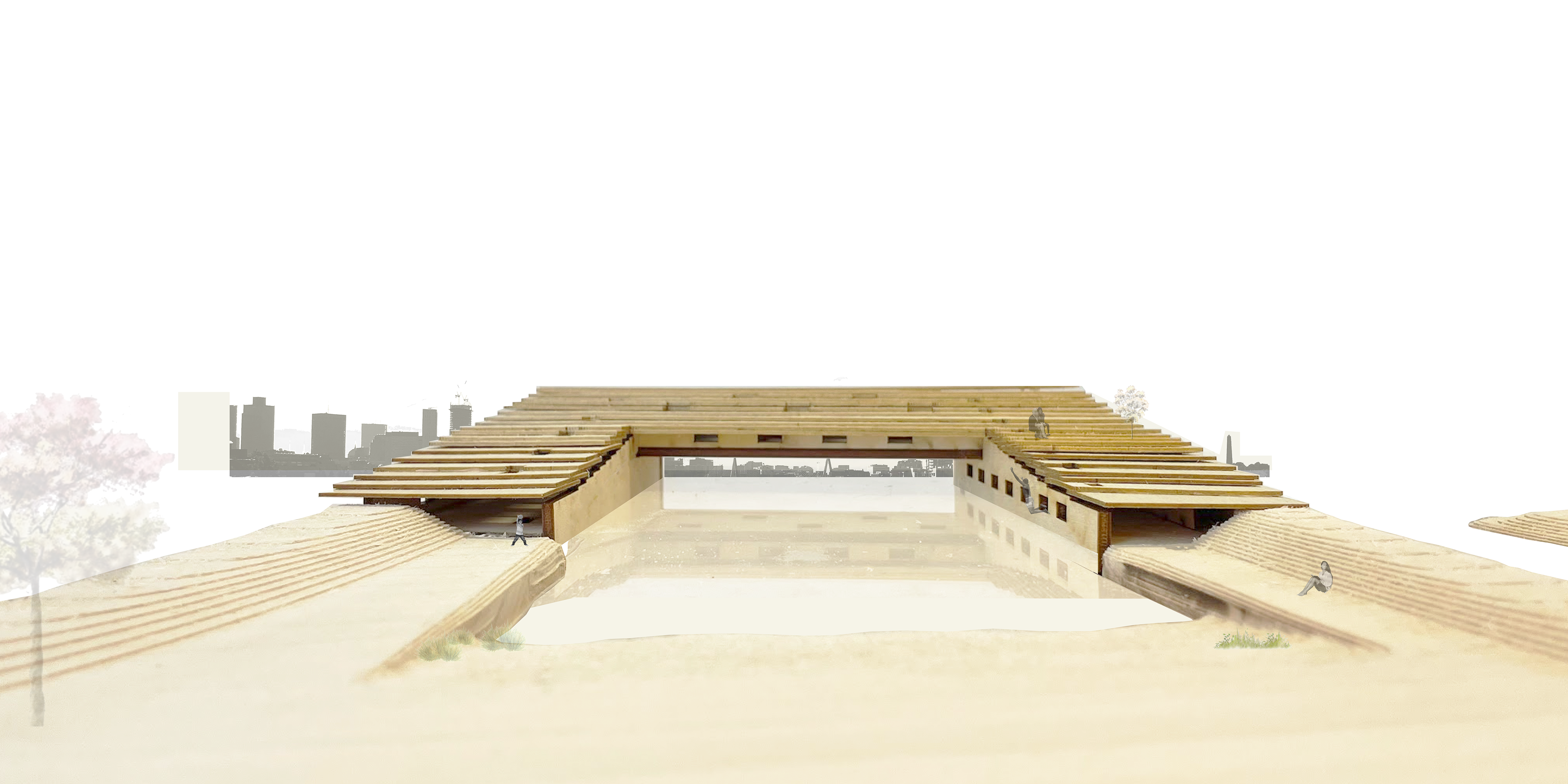
The three branches of the building are tailored to best suit East Boston's needs. The ferry terminal will provide regular transportation to the mainland, even when other forms of transit are cut off. The market provides a food source in an area where food can be hard to obtain, and the exhibition hall for local works allows visitors to celebrate the area's rich cultural heritage.
The existing landscape and new cape are graded to meet the building seamlessly; one side slopes up onto the green roof, while the other leads to the building's entrance.
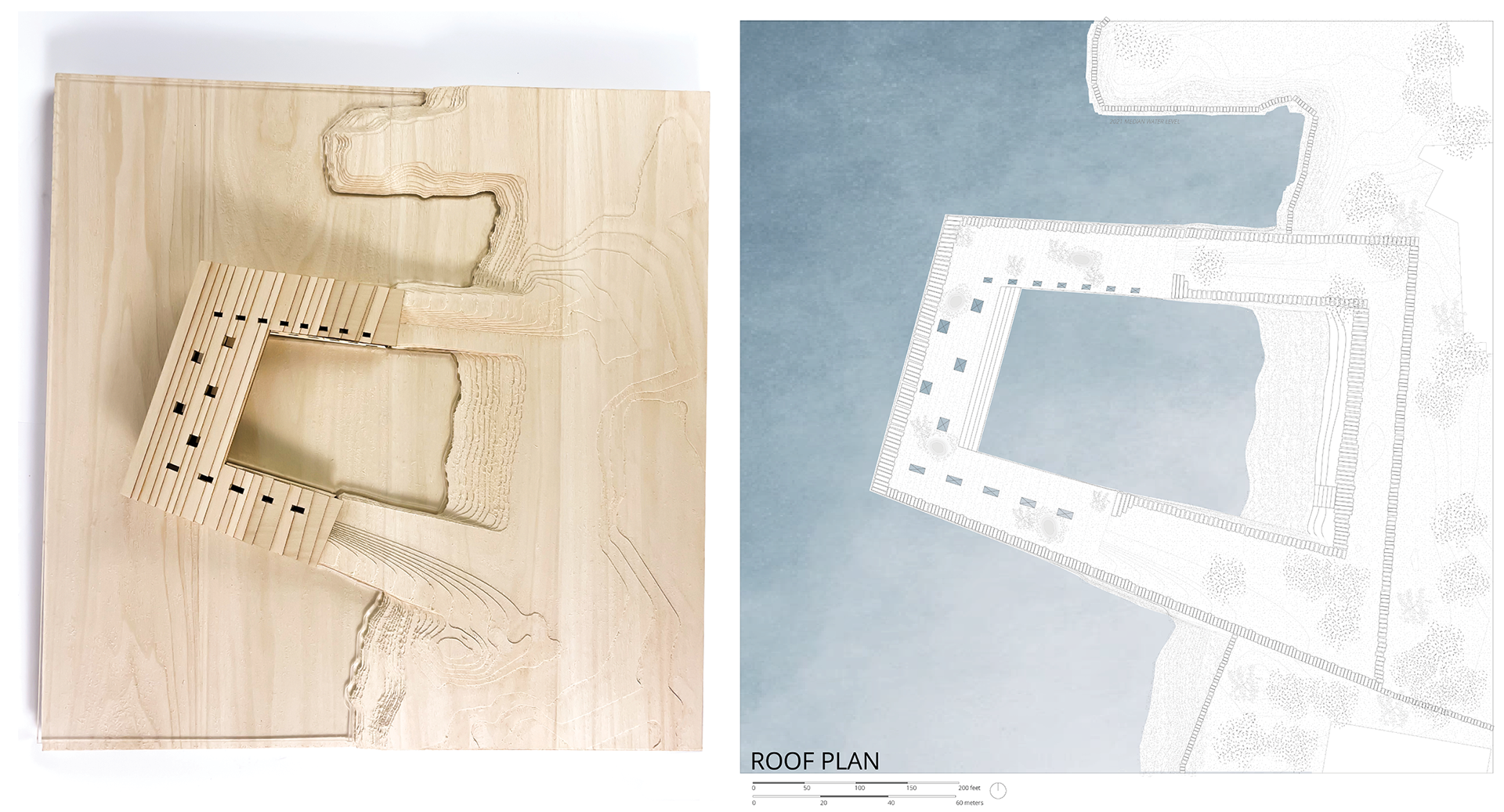
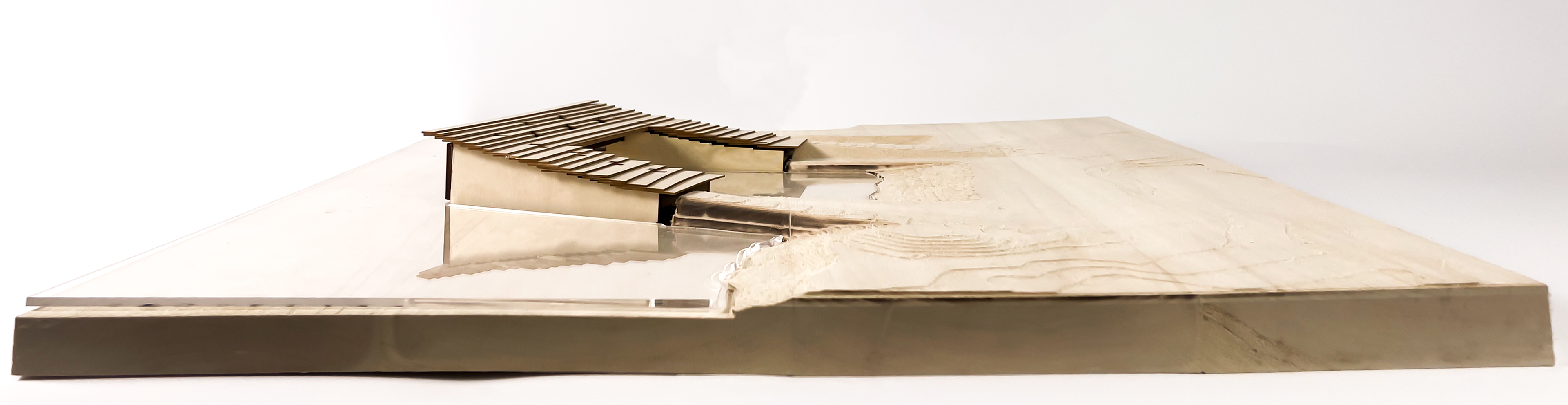
left: Top view of physical model (created with CNC milling and laser cutting)
right: Roof plan
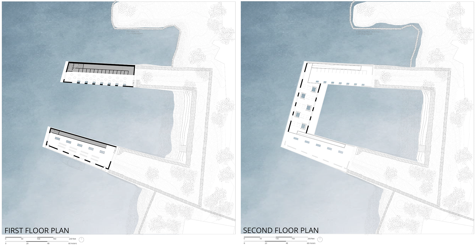
left: First floor plan
right: Second floor plan
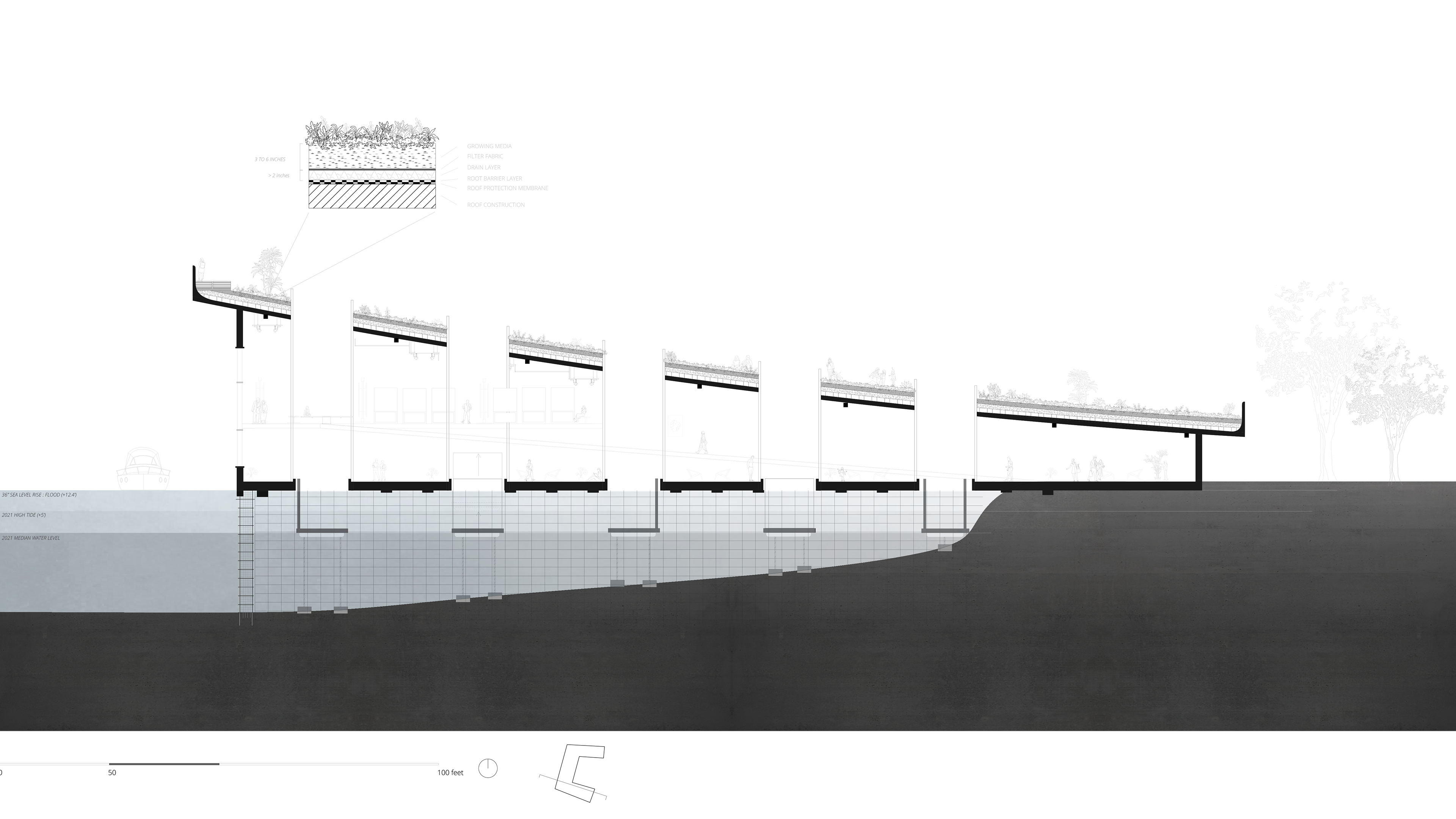
Voids, paired with floating platforms, through the building provide direct contact with the water below. A green roof adds public space and helps to mitigate stormwater flooding.